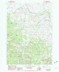
1982 Map of Soda Peak
USGS Topo · Published 1982About this map
Bear River dominates the northern and eastern landscape of this 1982 survey, winding through the valley near the Union Pacific rail line and the small settlement of Manson. The map reveals a high-elevation agricultural and resource-driven economy, evidenced by the Largilliere Ditch irrigation system and scattered grain bins and check dams used to manage water and harvest. To the south, the terrain rises sharply into the Bear River Range and the Cache National Forest, a territory marked by numerous named springs such as Willow Flat Spring and Little Joe Spring. Historically, the area reflects a mix of recreation and forest management, from the Camp Ho-Nok camp to the Eightmile FS Station. Trails like the Bailey Creek Trail and Hollow Trail provide the primary access into the steep backcountry around Soda Peak and the Cheatbeck Basin.
Find a feature on this map
43 named features on this map. Tap any name to fly to it.
Don’t see what you’re looking for? This feature index may not catch every label — zoom into the map to look around manually.
Map Details
Editions of this 1982 Soda Peak Map
This is the sole edition of this map. No revisions or reprints were ever made.
Other maps of this area

1909 · Montpelier
USGS Topo · 1:125,000

1911 · Montpelier
USGS Topo · 1:125,000

1911 · Slug Creek
USGS Topo · 1:62,500

1915 · Preston
USGS Topo · 1:96,000

1918 · Preston
USGS Topo · 1:125,000

1948 · Soda Springs
USGS Topo · 1:62,500

1949 · Soda Springs
USGS Topo · 1:62,500

1949 · Johnson Creek
USGS Topo · 1:24,000
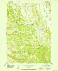
1951 · Johnson Creek
USGS Topo · 1:24,000

1955 · Preston
USGS Topo · 1:250,000