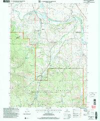
2005 Map of Soda Peak
USGS Topo · Published 2007About this map
Bear River meanders across the northern plains of this Bear Lake County landscape, serving as a vital artery for the surrounding agricultural and ranching community. The valley floor is crisscrossed by a network of rural routes such as Gunnell Road and Nounan Road, leading toward the small settlement of Manson. To the south, the terrain rises sharply into the Bear River Range, where the map documents the transition from lowland pastures to the protected lands of the Cache National Forest. In this higher elevation, several forks of Eightmile Creek and Bailey Creek carve through the mountains. Local history and civic development are anchored by the Eightmile Sch and Eightmile Cem, while the industrial presence is marked by a Gravel Pit and a Gaging Station monitoring the river’s flow.
Find a feature on this map
28 named features on this map. Tap any name to fly to it.
Don’t see what you’re looking for? This feature index may not catch every label — zoom into the map to look around manually.
Map Details
Editions of this 2005 Soda Peak Map
This is the sole edition of this map. No revisions or reprints were ever made.
Other maps of this area

1909 · Montpelier
USGS Topo · 1:125,000

1911 · Montpelier
USGS Topo · 1:125,000

1911 · Slug Creek
USGS Topo · 1:62,500

1915 · Preston
USGS Topo · 1:96,000

1918 · Preston
USGS Topo · 1:125,000

1948 · Soda Springs
USGS Topo · 1:62,500

1949 · Soda Springs
USGS Topo · 1:62,500

1949 · Johnson Creek
USGS Topo · 1:24,000
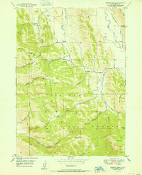
1951 · Johnson Creek
USGS Topo · 1:24,000

1955 · Preston
USGS Topo · 1:250,000