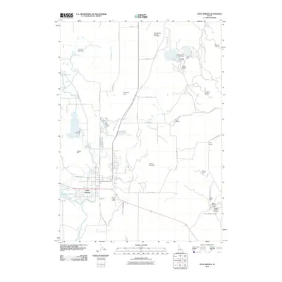
2010 Map of Soda Springs
USGS Topo · Published 2010About this map
Soda Springs and the nearby mining settlement of Conda define this Caribou County landscape during the early 21st century. The region's industrial character is marked by the Conda Mine and significant infrastructure including the Conda Site Tailings Dam and Beker Tailings Number Three Dam. These sites, along with the Idaho Sulphur Mine and Dewey Sulphur Mine in the southeastern canyons, reflect a long history of mineral extraction in the area.
Find a feature on this map
46 named features on this map. Tap any name to fly to it.
Don’t see what you’re looking for? This feature index may not catch every label — zoom into the map to look around manually.
Map Details
Editions of this 2010 Soda Springs Map
This is the sole edition of this map. No revisions or reprints were ever made.
Other maps of this area

1911 · Slug Creek
USGS Topo · 1:62,500

1914 · Henry
USGS Topo · 1:48,000

1915 · Lanes Creek
USGS Topo · 1:62,500

1916 · Henry
USGS Topo · 1:62,500

1948 · Soda Springs
USGS Topo · 1:62,500

1949 · Soda Springs
USGS Topo · 1:62,500

1949 · Johnson Creek
USGS Topo · 1:24,000

1949 · Lower Valley
USGS Topo · 1:24,000

1951 · Lower Valley
USGS Topo · 1:24,000
1951 · Johnson Creek
USGS Topo · 1:24,000