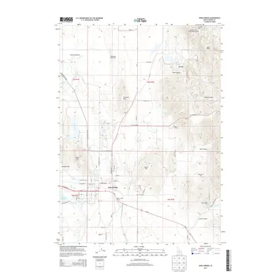
2013 Map of Soda Springs
USGS Topo · Published 2013About this map
Alexander Reservoir and the Bear River define the southwestern landscape of this Caribou County region, where the town of Soda Springs serves as a hub for industry and transport. To the north, the geography shifts toward the volcanic origins of the Blackfoot Lava Field and the notable Columbia River Great Basin Divide, which crosses the high terrain near Woodall Mtn. The map documents a significant industrial footprint concentrated in the eastern canyons and ridges of the Aspen Range.
Find a feature on this map
60 named features on this map. Tap any name to fly to it.
Don’t see what you’re looking for? This feature index may not catch every label — zoom into the map to look around manually.
Map Details
Editions of this 2013 Soda Springs Map
This is the sole edition of this map. No revisions or reprints were ever made.
Other maps of this area

1911 · Slug Creek
USGS Topo · 1:62,500

1914 · Henry
USGS Topo · 1:48,000

1915 · Lanes Creek
USGS Topo · 1:62,500

1916 · Henry
USGS Topo · 1:62,500

1948 · Soda Springs
USGS Topo · 1:62,500

1949 · Soda Springs
USGS Topo · 1:62,500

1949 · Johnson Creek
USGS Topo · 1:24,000

1949 · Lower Valley
USGS Topo · 1:24,000

1951 · Lower Valley
USGS Topo · 1:24,000
1951 · Johnson Creek
USGS Topo · 1:24,000