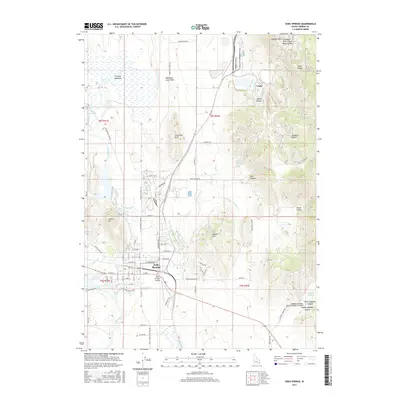
2017 Map of Soda Springs
USGS Topo · Published 2017About this map
Soda Springs is the primary hub of this eastern Idaho landscape, where the town layout is defined by its proximity to the Bear River and the Alexander Reservoir. The map illustrates a unique geological setting where the Blackfoot Lava Field meets the western slopes of the Aspen Range. Historically significant water features like Hooper Spring and Formation Spring are documented near the town site, alongside Soda Creek and the industrial infrastructure of the Soda Canal.
Find a feature on this map
78 named features on this map. Tap any name to fly to it.
Don’t see what you’re looking for? This feature index may not catch every label — zoom into the map to look around manually.
Map Details
Editions of this 2017 Soda Springs Map
This is the sole edition of this map. No revisions or reprints were ever made.
Other maps of this area

1911 · Slug Creek
USGS Topo · 1:62,500

1914 · Henry
USGS Topo · 1:48,000

1915 · Lanes Creek
USGS Topo · 1:62,500

1916 · Henry
USGS Topo · 1:62,500

1948 · Soda Springs
USGS Topo · 1:62,500

1949 · Soda Springs
USGS Topo · 1:62,500

1949 · Johnson Creek
USGS Topo · 1:24,000

1949 · Lower Valley
USGS Topo · 1:24,000

1951 · Lower Valley
USGS Topo · 1:24,000
1951 · Johnson Creek
USGS Topo · 1:24,000