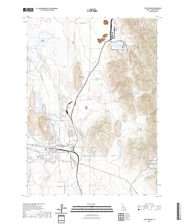
2024 Map of Soda Springs
USGS Topo · Published 2024About this map
Soda Springs serves as the focal point of this Caribou County landscape, situated at a geologic crossroads where the Blackfoot Lava Field meets the heights of the Aspen Range. The town's historic identity is deeply tied to its mineral waters, evidenced by the clustered locations of Hooper Spring, Mammoth Spring, and Formation Spring along the drainage of Soda Creek. Modern infrastructure like the Allen H Tigert Airport and the Caribou County Courthouse anchor the municipal center, while the grid of Soda Springs transitions into the industrial outpost of Conda to the northeast.
Find a feature on this map
83 named features on this map. Tap any name to fly to it.
Don’t see what you’re looking for? This feature index may not catch every label — zoom into the map to look around manually.
Map Details
Editions of this 2024 Soda Springs Map
This is the sole edition of this map. No revisions or reprints were ever made.
Other maps of this area

1911 · Slug Creek
USGS Topo · 1:62,500

1914 · Henry
USGS Topo · 1:48,000

1915 · Lanes Creek
USGS Topo · 1:62,500

1916 · Henry
USGS Topo · 1:62,500

1948 · Soda Springs
USGS Topo · 1:62,500

1949 · Soda Springs
USGS Topo · 1:62,500

1949 · Johnson Creek
USGS Topo · 1:24,000

1949 · Lower Valley
USGS Topo · 1:24,000

1951 · Lower Valley
USGS Topo · 1:24,000
1951 · Johnson Creek
USGS Topo · 1:24,000