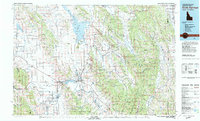
1982 Map of Soda Springs
USGS Topo · Published 1982About this map
Soda Springs and the surrounding high-desert basins of the Gem Valley and Portneuf Valley are defined here by a dense network of water and rail. The Union Pacific railroad cuts a steady line through settlements like Bancroft, Alexander, and Lund, reflecting the regional reliance on transit for both agriculture and the emerging phosphate industry near Conda. In the northern reach, the Blackfoot Reservoir dominates the landscape, dotted with islands such as Sheep Island and Cinder Island, while the Fort Hall Indian Reservation occupies the northwest corner. Genealogists will find several burial grounds documented, including the Chesterfield Cem and Soda Springs Cem. The topography is a complex system of north-south trending ridges, including the Chesterfield Range and Aspen Range, which hem in the drainage of the Bear River and Blackfoot River.
Find a feature on this map
127 named features on this map. Tap any name to fly to it.
Don’t see what you’re looking for? This feature index may not catch every label — zoom into the map to look around manually.
Map Details
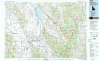
Editions of this 1982 Soda Springs Map
2 editions found
Other maps of this area

1909 · Montpelier
USGS Topo · 1:125,000

1911 · Montpelier
USGS Topo · 1:125,000

1911 · Slug Creek
USGS Topo · 1:62,500

1914 · Henry
USGS Topo · 1:48,000

1915 · Preston
USGS Topo · 1:96,000

1915 · Freedom
USGS Topo · 1:62,500

1915 · Crow Creek
USGS Topo · 1:62,500

1915 · Lanes Creek
USGS Topo · 1:62,500

1916 · Henry
USGS Topo · 1:62,500

1917 · Portneuf
USGS Topo · 1:62,500