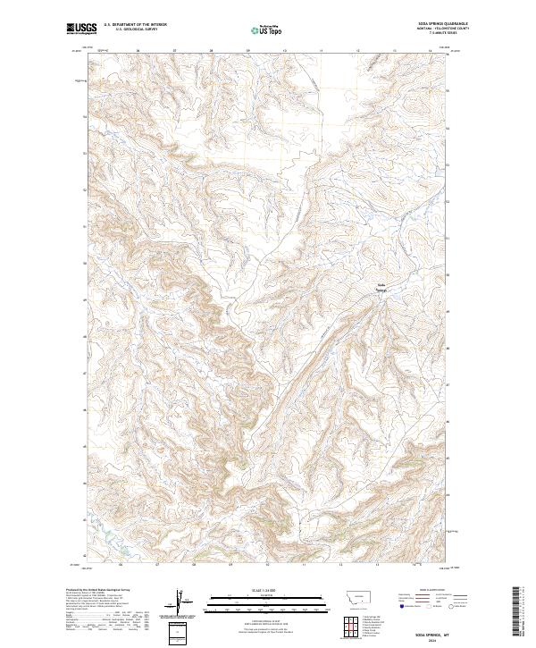
2024 Map of Soda Springs
USGS Topo · Published 2024About this map
Soda Springs serves as the central landmark for this Montana landscape, where the high-altitude drainage systems of the Pryor Mountains shape the local topography. This 2024 survey captures the intricate network of coulees and seasonal waterways, including East Wets Creek and Lone Tree Coulee, which flow through the dissected plateaus of Yellowstone County. The map provides a contemporary look at the rural infrastructure in the Crow Indian Reservation area, particularly along the Indian Svc Rd and Vermandel Rd. The southern portion of the quadrangle is dominated by the headwaters of the East Fork Pryor Creek and East Pryor Creek, illustrating how the hydrology of this semi-arid region continues to define land use and transportation routes. These features are key for understanding the modern footprint of tribal lands and ranching activity.
Find a feature on this map
14 named features on this map. Tap any name to fly to it.
Don’t see what you’re looking for? This feature index may not catch every label — zoom into the map to look around manually.
Map Details
Editions of this 2024 Soda Springs Map
This is the sole edition of this map. No revisions or reprints were ever made.
Other maps of this area

1893 · Huntley
USGS Topo · 1:125,000

1954 · Billings
USGS Topo · 1:250,000

1957 · Billings
USGS Topo · 1:250,000

1958 · Billings
USGS Topo · 1:250,000

1967 · Deep Creek
USGS Topo · 1:24,000

1967 · Soda Springs NW
USGS Topo · 1:24,000

1967 · Soda Springs
USGS Topo · 1:24,000
1967 · Chilkoot Coulee
USGS Topo · 1:24,000
1967 · Badbaby Coulee
USGS Topo · 1:24,000
1967 · Vale Creek Ranch
USGS Topo · 1:24,000