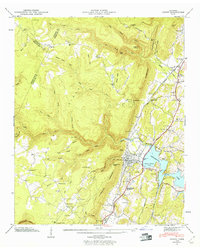
1946 Map of Soddy
USGS Topo · Published 1960About this map
The town of Soddy and its industrial core anchor this mid-century survey, situated where the Cumberland Ridge drops sharply at the Escarpment toward the waters of Chickamauga Lake. The landscape reveals a transition from the structured street grid and rail-oriented industry near Rathburn Station to the more dispersed upland settlements of Flat Top and Huckleberry. Notable cultural landmarks like the Soddy-Daisy High School and Soddy Marine Park reflect the community's growth following the impoundment of the lake.
Find a feature on this map
92 named features on this map. Tap any name to fly to it.
Don’t see what you’re looking for? This feature index may not catch every label — zoom into the map to look around manually.
Map Details
Editions of this 1946 Soddy Map
2 editions found
Other maps of this area

1888 · Chattanooga
USGS Topo · 1:125,000

1893 · Chattanooga
USGS Topo · 1:125,000

1935 · Daisy
USGS Topo · 1:24,000

1935 · Soddy
USGS Topo · 1:24,000

1935 · Snow Hill
USGS Topo · 1:24,000

1935 · Brayton
USGS Topo · 1:24,000

1935 · Mount Airy
USGS Topo · 1:24,000

1935 · Soddy Island
USGS Topo · 1:24,000
1935 · Graysville
USGS Topo · 1:24,000

1936 · Henson Gap
USGS Topo · 1:24,000