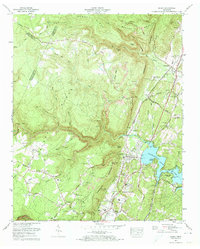
1972 Map of Soddy
USGS Topo · Published 1974About this map
Walden Ridge and the Cumberland Escarpment define the topography of this Hamilton County region during the early 1970s. The landscape is a study in industrial and residential change, where numerous Strip mines and a Quarry sit adjacent to developing lakeside communities like Soddy Lake Heights on the shores of Chickamauga Lake. The settlement pattern follows the Southern Railway and Old Dayton Pike through Bakewell and Soddy-Daisy, while the high plateau to the west remains more dispersed, anchored by local institutions like Mowbray Ch and Mowbray Sch. Genealogists will find a wealth of family history preserved in the numerous upland burial grounds, including the Millsaps Cem, Hotwater Cem, and Granby Walker Cem. The map also captures the complex hydrology of the area, from the deep incisions of Bakewell Gulf to the winding course of Soddy Creek.
Find a feature on this map
74 named features on this map. Tap any name to fly to it.
Don’t see what you’re looking for? This feature index may not catch every label — zoom into the map to look around manually.
Map Details
Editions of this 1972 Soddy Map
2 editions found
Other maps of this area

1888 · Chattanooga
USGS Topo · 1:125,000

1893 · Chattanooga
USGS Topo · 1:125,000

1935 · Daisy
USGS Topo · 1:24,000

1935 · Soddy
USGS Topo · 1:24,000

1935 · Snow Hill
USGS Topo · 1:24,000

1935 · Brayton
USGS Topo · 1:24,000

1935 · Mount Airy
USGS Topo · 1:24,000

1935 · Soddy Island
USGS Topo · 1:24,000
1935 · Graysville
USGS Topo · 1:24,000

1936 · Henson Gap
USGS Topo · 1:24,000