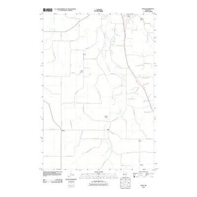
2010 Map of Sogn
USGS Topo · Published 2010About this map
The Little Cannon River meanders through this portion of Goodhue County, defining a landscape of agricultural tradition and dispersed rural settlements. The small communities of Wangs and Sogn serve as focal points for the surrounding farmsteads, connected by a network of established routes like County Hwy-9 and Sogn Valley Trl. For genealogists and local historians, the sheet is particularly valuable for its clear documentation of several regional burying grounds, including Saint Ansgars Cemetery, Wangen Prairie Cemetery, and Urland Cemetery. These sites, along with landmarks like the George Lamberty Dam and the private Edberg Landing Strip, illustrate the enduring land use patterns of the region. The topography remains defined by the winding paths of Prairie Creek and its tributaries, which have shaped the placement of roads and homesteads for generations.
Find a feature on this map
55 named features on this map. Tap any name to fly to it.
Don’t see what you’re looking for? This feature index may not catch every label — zoom into the map to look around manually.
Map Details
Editions of this 2010 Sogn Map
This is the sole edition of this map. No revisions or reprints were ever made.
Other maps of this area

1953 · Saint Paul
USGS Topo · 1:250,000

1957 · Farmington
USGS Topo · 1:62,500

1957 · Hastings
USGS Topo · 1:62,500

1959 · Saint Paul
USGS Topo · 1:250,000

1960 · Dennison
USGS Topo · 1:24,000

1960 · Nerstrand
USGS Topo · 1:24,000

1968 · Kenyon
USGS Topo · 1:24,000

1968 · Sogn
USGS Topo · 1:24,000

1968 · Wanamingo
USGS Topo · 1:24,000

1968 · White Rock
USGS Topo · 1:24,000