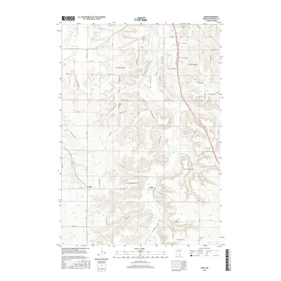
2016 Map of Sogn
USGS Topo · Published 2016About this map
Sogn and Wangs anchor this rural landscape in Goodhue County, where the dendritic drainage of the Little Cannon River and Prairie Cr carves into the upland plateau. The map reveals a deeply rooted settlement pattern defined by its namesake Norwegian heritage, seen in the density of rural burial grounds like Wangen Prairie Cem and Urland Cem. This 2016 survey documents the enduring grid of the Public Land Survey System, where modern county roads like CO 24 Blvd and CO 9 Blvd follow historical township lines. The terrain is characterized by steep-sided coulees and high ridges, particularly around Butler Cr, illustrating the transition from agricultural tablelands to the river valleys that feed the larger Cannon River system to the north.
Find a feature on this map
67 named features on this map. Tap any name to fly to it.
Don’t see what you’re looking for? This feature index may not catch every label — zoom into the map to look around manually.
Map Details
Editions of this 2016 Sogn Map
This is the sole edition of this map. No revisions or reprints were ever made.
Other maps of this area

1953 · Saint Paul
USGS Topo · 1:250,000

1957 · Farmington
USGS Topo · 1:62,500

1957 · Hastings
USGS Topo · 1:62,500

1959 · Saint Paul
USGS Topo · 1:250,000

1960 · Dennison
USGS Topo · 1:24,000

1960 · Nerstrand
USGS Topo · 1:24,000

1968 · Kenyon
USGS Topo · 1:24,000

1968 · Sogn
USGS Topo · 1:24,000

1968 · Wanamingo
USGS Topo · 1:24,000

1968 · White Rock
USGS Topo · 1:24,000