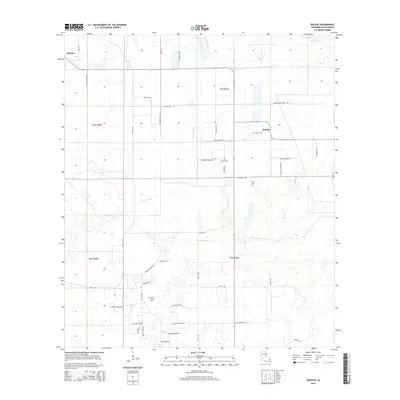
2015 Map of Soileau
USGS Topo · Published 2015About this map
Sonnier Bayou meanders through this portion of Allen Parish, defining a landscape marked by rural homesteads and agricultural plots connected by an extensive network of family-named roads. This 2015 survey reveals the spatial relationship between the larger settlement at Oberlin and the smaller community of Soileau, illustrating the enduring nature of local land divisions and ownership. The region’s history is anchored by sites like Saint Peters Cem, Sonnier Cem, and Cole Cem, which serve as important touchstones for genealogical research in this part of Louisiana. The transition from the drainages of Castor Creek to the marshy corridors of Coulee Bayou and Cyrus Gully reflects the intricate hydrology that has influenced the placement of farms and cemeteries across the townships.
Find a feature on this map
51 named features on this map. Tap any name to fly to it.
Don’t see what you’re looking for? This feature index may not catch every label — zoom into the map to look around manually.
Map Details
Editions of this 2015 Soileau Map
This is the sole edition of this map. No revisions or reprints were ever made.
Other maps of this area

1947 · Kinder
USGS Topo · 1:31,680

1947 · Fruge Lake
USGS Topo · 1:31,680

1947 · Foley
USGS Topo · 1:31,680

1947 · Oberlin
USGS Topo · 1:31,680

1947 · Pine Chapel
USGS Topo · 1:31,680

1947 · Elton
USGS Topo · 1:31,680

1947 · Bond
USGS Topo · 1:31,680

1947 · Basile
USGS Topo · 1:31,680
1948 · Pine Chapel
USGS Topo · 1:24,000

1949 · Bayou Blue
USGS Topo · 1:31,680