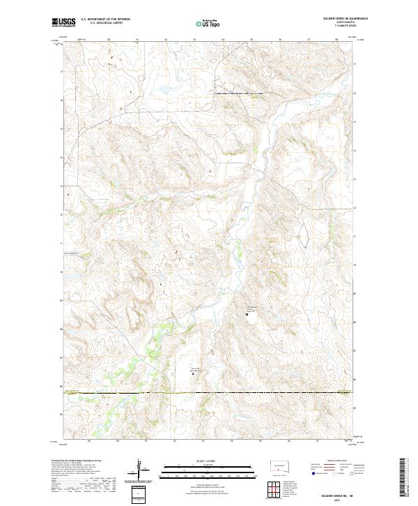
2021 Map of Soldier Creek NE
USGS Topo · Published 2021About this map
The Little White River winds through the heart of this landscape, carving a complex drainage system across the boundary of Mellette and Todd Counties. This 2021 survey reveals a territory defined by its watercourses and rural cemeteries, which serve as primary landmarks in an otherwise open terrain. The Ring Thunder Sacred Heart Cem and Saint John Episcopal Cem provide specific points of historical and genealogical interest, suggesting the deep-rooted presence of local communities along these high plains. Transport is marked by the presence of Ring Thunder Rd, while the topography is further shaped by several named tributaries including Cut Meat Cr, Little Oak Cr, and Dry Cr. The map's detailed contouring highlights the subtle elevation shifts between the river valley and the surrounding upland plateaus.
Find a feature on this map
15 named features on this map. Tap any name to fly to it.
Don’t see what you’re looking for? This feature index may not catch every label — zoom into the map to look around manually.
Map Details
Editions of this 2021 Soldier Creek NE Map
This is the sole edition of this map. No revisions or reprints were ever made.
Other maps of this area

1955 · Martin
USGS Topo · 1:250,000

1958 · Martin
USGS Topo · 1:250,000

1969 · Soldier Creek NE
USGS Topo · 1:24,000

1969 · Soldier Creek
USGS Topo · 1:24,000

1969 · Mission NW
USGS Topo · 1:24,000

1969 · Mission
USGS Topo · 1:24,000

1969 · Soldier Creek NW
USGS Topo · 1:24,000

1969 · Soldier Creek SE
USGS Topo · 1:24,000
1982 · Murdo 3 NW
USGS Topo · 1:25,000

1982 · White River East
USGS Topo · 1:24,000
Featured Places
- Ring Thunder Segment, SD
- Soldier Creek Segment, SD
- Horse Creek Segment, SD
- Antelope Segment, SD
- Todd County, SD