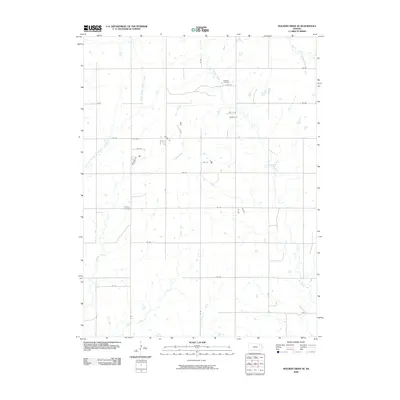
2009 Map of Soldier Creek SE
USGS Topo · Published 2009About this map
Mitchell Cemetery and Shipsee Cemetery anchor this rural Jackson County landscape, reflecting the long-established burial sites that persist within the township grid. The terrain is defined by a dense network of watercourses, including the winding South Branch Soldier Creek and Little Soldier Creek, which carve through the prairie. The 2009 survey illustrates a predominantly agrarian region where the section-line road system, including routes like 174 RD and 118 RD, dictates the modern geography. Significant tributaries such as Dutch Creek and Walnut Creek drain the southern portion of the quadrangle, while the presence of numerous small ponds and catchment basins suggest the ongoing importance of water management for local agriculture and livestock in this part of Kansas.
Find a feature on this map
30 named features on this map. Tap any name to fly to it.
Don’t see what you’re looking for? This feature index may not catch every label — zoom into the map to look around manually.
Map Details
Editions of this 2009 Soldier Creek SE Map
This is the sole edition of this map. No revisions or reprints were ever made.
Other maps of this area

1889 · Topeka
USGS Topo · 1:125,000

1894 · Topeka
USGS Topo · 1:125,000

1950 · Kansas City
USGS Topo · 1:250,000

1952 · Rossville
USGS Topo · 1:24,000

1952 · Elmont
USGS Topo · 1:24,000

1952 · Grove
USGS Topo · 1:24,000

1954 · Kansas City
USGS Topo · 1:250,000

1956 · Kansas City
USGS Topo · 1:250,000

1960 · Kansas City
USGS Topo · 1:250,000
1960 · Mayetta
USGS Topo · 1:24,000