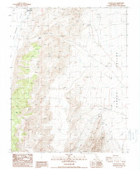
1987 Map of Soldier Pass
USGS Topo · Published 1988About this map
Deep Springs Valley and Eureka Valley are separated by the formidable mountain terrain of the Inyo Range in this late 20th-century survey. The landscape is defined by its isolation and the clear evidence of mineral exploration, particularly at the southern end of the sheet where the Loretto Mine and Vicky Cons Mine Prospects are located. These sites, along with numerous unnamed Prospects, indicate a history of hard-rock mining in these high-altitude desert reaches.
Find a feature on this map
13 named features on this map. Tap any name to fly to it.
Don’t see what you’re looking for? This feature index may not catch every label — zoom into the map to look around manually.
Map Details
Editions of this 1987 Soldier Pass Map
This is the sole edition of this map. No revisions or reprints were ever made.
Other maps of this area

1908 · Lida
USGS Topo · 1:250,000

1913 · Bishop
USGS Topo · 1:125,000

1913 · Lida
USGS Topo · 1:250,000

1947 · Mariposa
USGS Topo · 1:250,000

1948 · Mariposa
USGS Topo · 1:250,000

1951 · Blanco Mountain
USGS Topo · 1:62,500

1951 · Waucoba Mtn.
USGS Topo · 1:62,500

1954 · Goldfield
USGS Topo · 1:250,000

1955 · Goldfield
USGS Topo · 1:250,000

1957 · Mariposa
USGS Topo · 1:250,000