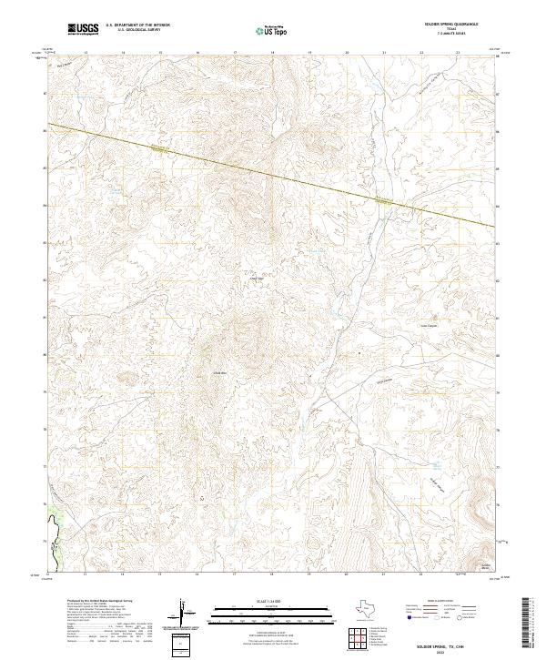
2022 Map of Soldier Spring
USGS Topo · Published 2022About this map
Van Horn Cr carves a central path through this arid stretch of West Texas, where the border between Jeff Davis Co and Presidio Co segments the high desert landscape. The terrain is defined by dramatic elevation changes, ranging from the prominent Chalk Mtn and Soldier Mesa to the depths of Hog Canyon and Joho Canyon. Human activity is concentrated along established corridors like Chispa Rd and the aptly named Coal Mine Rd, which hint at the region's historic mining and ranching infrastructure.
Find a feature on this map
20 named features on this map. Tap any name to fly to it.
Don’t see what you’re looking for? This feature index may not catch every label — zoom into the map to look around manually.
Map Details
Editions of this 2022 Soldier Spring Map
This is the sole edition of this map. No revisions or reprints were ever made.
Other maps of this area

1892 · Chispa
USGS Topo · 1:125,000

1895 · Chispa
USGS Topo · 1:125,000

1896 · San Carlos
USGS Topo · 1:125,000

1897 · Chispa
USGS Topo · 1:125,000

1959 · Marfa
USGS Topo · 1:250,000

1965 · Marfa
USGS Topo · 1:250,000
1972 · Mesquite Spring
USGS Topo · 1:24,000
1972 · Soldier Spring
USGS Topo · 1:24,000

1972 · Chispa
USGS Topo · 1:24,000
1972 · Ninetysix Ranch
USGS Topo · 1:24,000