
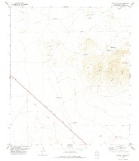
1972 Map of Chispa
USGS Topo · Published 1975About this map
Lobo Valley (Depression) dominates this Far West Texas landscape, where the flat expanse of the high desert basin meets the dramatic rise of the Sierra Vieja. In the early 1970s, this area remained sparsely populated, defined by cattle ranching and the transit corridor of the Southern Pacific railroad. The small settlement of Chispa and nearby C Means Ranch sit at the northern edge of the valley, while White Ranch occupies the center. Water management is the primary concern in this arid environment, evidenced by scattered infrastructure like Ninety-six Windmill and the Ninety-six Spring. Topographic details reveal the complex drainage of Wild Horse Draw and the breaks of the mountains at Ninety-six Gap, providing a clear record of land use and ranching boundaries in Jeff Davis County.
Find a feature on this map
16 named features on this map. Tap any name to fly to it.
Don’t see what you’re looking for? This feature index may not catch every label — zoom into the map to look around manually.
Map Details
Editions of this 1972 Chispa Map
This is the sole edition of this map. No revisions or reprints were ever made.
Other maps of this area

1892 · Chispa
USGS Topo · 1:125,000

1895 · Chispa
USGS Topo · 1:125,000

1897 · Chispa
USGS Topo · 1:125,000

1959 · Marfa
USGS Topo · 1:250,000

1965 · Marfa
USGS Topo · 1:250,000
1972 · Lobo
USGS Topo · 1:24,000
1972 · Soldier Spring
USGS Topo · 1:24,000
1972 · Ninetysix Ranch
USGS Topo · 1:24,000
1972 · Chispa Mountain
USGS Topo · 1:24,000
1978 · Dowman Canyon
USGS Topo · 1:24,000