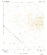
1978 Map of Dowman Canyon
USGS Topo · Published 1978About this map
The Southern Pacific railroad cuts a sharp diagonal across this arid corner of Jeff Davis County, defining the corridor of transport through the West Texas landscape. The terrain is characterized by the prominent Y-6 Hills and the winding course of Dowman Canyon. Water management is the primary marker of human activity here, evidenced by a dense network of specialized infrastructure including Agua Caliente Lodge, Sauerkraut Windmill, and Caliche Windmill.
Find a feature on this map
17 named features on this map. Tap any name to fly to it.
Don’t see what you’re looking for? This feature index may not catch every label — zoom into the map to look around manually.
Map Details
Editions of this 1978 Dowman Canyon Map
This is the sole edition of this map. No revisions or reprints were ever made.
Other maps of this area

1892 · Chispa
USGS Topo · 1:125,000

1894 · Valentine
USGS Topo · 1:125,000

1895 · Chispa
USGS Topo · 1:125,000

1897 · Valentine
USGS Topo · 1:125,000

1897 · Chispa
USGS Topo · 1:125,000

1943 · Valentine
USGS Topo · 1:125,000

1959 · Marfa
USGS Topo · 1:250,000

1965 · Marfa
USGS Topo · 1:250,000

1972 · Chispa
USGS Topo · 1:24,000
1972 · Chispa Mountain
USGS Topo · 1:24,000