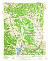
1939 Map of Soldier Summit
USGS Topo · Published 1965About this map
Soldier Summit sits at the high point of this 1939 survey, marking a critical mountain pass where the Denver and Rio Grande Western railroad traverses the Colorado River Great Basin Watershed Divide. The map details a landscape defined by its rail-and-resource economy, showing the transit hubs of Tucker and Gilluly along the line, and the Pondtown Mine to the south. The southern portion of the sheet is dominated by the Scofield Reservoir and the Price River, while family-run operations such as Daniels Ranch and Richards Ranch dot the valleys between Bennion Ridge and Aagard Ridge. Topography by R. T. Evans and W. B. Upton, Jr. captures the transition from the Uinta National Forest to the Manti-La Sal National Forest, documenting the complex network of spring-fed canyons and high-altitude flats before mid-century modernization.
Find a feature on this map
80 named features on this map. Tap any name to fly to it.
Don’t see what you’re looking for? This feature index may not catch every label — zoom into the map to look around manually.
Map Details
Editions of this 1939 Soldier Summit Map
3 editions found

Other maps of this area

1885 · Salt Lake
USGS Topo · 1:250,000

1885 · Manti
USGS Topo · 1:250,000

1885 · Uinta
USGS Topo · 1:250,000

1886 · Price River
USGS Topo · 1:250,000

1895 · Manti
USGS Topo · 1:250,000

1896 · Price River
USGS Topo · 1:250,000

1907 · Strawberry Valley
USGS Topo · 1:125,000

1909 · Strawberry Valley
USGS Topo · 1:125,000

1914 · Castle Gate
USGS Topo · 1:62,500

1916 · Castle Gate
USGS Topo · 1:62,500