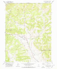
1978 Map of Soldier Summit
USGS Topo · Published 1979About this map
Soldier Summit sits at the topographical and logistical heart of this late-1970s survey, marking a vital mountain pass where the Denver and Rio Grande Western railroad crosses the high divide between the Great Basin and the Colorado River drainage. This alpine corridor, defined by the winding course of Soldier Creek and the headwaters of the White River, serves as a critical transportation artery through the Uinta National Forest.
Find a feature on this map
38 named features on this map. Tap any name to fly to it.
Don’t see what you’re looking for? This feature index may not catch every label — zoom into the map to look around manually.
Map Details
Editions of this 1978 Soldier Summit Map
2 editions found
Other maps of this area

1885 · Salt Lake
USGS Topo · 1:250,000

1885 · Manti
USGS Topo · 1:250,000

1885 · Uinta
USGS Topo · 1:250,000

1886 · Price River
USGS Topo · 1:250,000

1895 · Manti
USGS Topo · 1:250,000

1896 · Price River
USGS Topo · 1:250,000

1907 · Strawberry Valley
USGS Topo · 1:125,000

1909 · Strawberry Valley
USGS Topo · 1:125,000

1939 · Soldier Summit
USGS Topo · 1:62,500

1942 · Soldier Summit
USGS Topo · 1:62,500