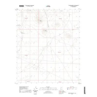
2020 Map of Soldiers Farewell Hill
USGS Topo · Published 2020About this map
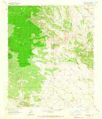
Soldiers Farewell Hill stands as a prominent landmark in this desert landscape of Grant County, marking a terrain defined by volcanic hills and seasonal watercourses. The drainage of Burro Cienaga cuts through the center of the sheet, providing a vital geographic corridor through the arid environment. Local landmarks named for early residents or surveyors include Bessie Rhoads Mtn and JPB Mtn, alongside features like South Well Canyon and China Draw. The map records a modern network of ranching and utility roads, such as Gage Rd and the Access to Gage Rd, which navigate the space between the Malpais Hills and various livestock water sources like Jarrell Tank Number 1. This survey provides a precise account of the high-desert topography and range improvements as they existed in the early 21st century.
Find a feature on this map
19 named features on this map. Tap any name to fly to it.
Don’t see what you’re looking for? This feature index may not catch every label — zoom into the map to look around manually.
Map Details
Editions of this 2020 Soldiers Farewell Hill Map
This is the sole edition of this map. No revisions or reprints were ever made.
Other maps of this area

1954 · Silver City
USGS Topo · 1:250,000

1958 · Silver City
USGS Topo · 1:250,000

1962 · Silver City
USGS Topo · 1:250,000

1962 · Ninetysix Ranch
USGS Topo · 1:24,000

1963 · Soldiers Farewell Hill
USGS Topo · 1:24,000
1963 · Cow Springs Mountain
USGS Topo · 1:24,000

1963 · Gage NW
USGS Topo · 1:24,000
1963 · Werney Hill
USGS Topo · 1:24,000
1963 · Grandmother Mountain West
USGS Topo · 1:24,000
1963 · C Bar Ranch
USGS Topo · 1:24,000