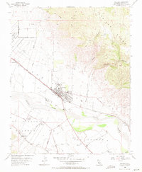
1955 Map of Soledad
USGS Topo · Published 1971About this map
The Salinas River valley floor dominated by industrial agriculture and early 20th-century transportation networks characterizes this mid-century survey. The city of Soledad serves as the central hub, situated along the Southern Pacific railroad and bisected by a grid of schools and local infrastructure. To the northwest, the Soledad State Prison appears as a significant institutional presence near the Soledad Grant Boundary.
Find a feature on this map
31 named features on this map. Tap any name to fly to it.
Don’t see what you’re looking for? This feature index may not catch every label — zoom into the map to look around manually.
Map Details
Editions of this 1955 Soledad Map
4 editions found
Other maps of this area

1910 · Gonzales
USGS Topo · 1:31,680

1910 · Soledad
USGS Topo · 1:31,680

1912 · Metz
USGS Topo · 1:31,680

1915 · Soledad
USGS Topo · 1:62,500

1919 · San Benito
USGS Topo · 1:62,500

1921 · Gonzales
USGS Topo · 1:62,500

1921 · Metz
USGS Topo · 1:62,500

1931 · San Benito
USGS Topo · 1:62,500

1940 · Metz
USGS Topo · 1:62,500

1940 · Soledad
USGS Topo · 1:62,500