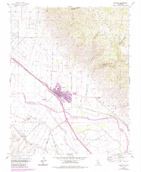
1955 Map of Soledad
USGS Topo · Published 1984About this map
The Salinas River valley serves as the central corridor for this 1955 survey, where the Southern Pacific railroad and early highways like Metz Soledad Road connect agricultural hubs. The town of Soledad is the primary settlement, showing significant mid-century expansion near the San Vicente School. Cultural and institutional landmarks are prominent throughout the landscape, from the Soledad State Prison in the northwest to the Mission Soledad (Ruins) and the Fort Romie area.
Find a feature on this map
28 named features on this map. Tap any name to fly to it.
Don’t see what you’re looking for? This feature index may not catch every label — zoom into the map to look around manually.
Map Details
Editions of this 1955 Soledad Map
4 editions found
Other maps of this area

1910 · Gonzales
USGS Topo · 1:31,680

1910 · Soledad
USGS Topo · 1:31,680

1912 · Metz
USGS Topo · 1:31,680

1915 · Soledad
USGS Topo · 1:62,500

1919 · San Benito
USGS Topo · 1:62,500

1921 · Gonzales
USGS Topo · 1:62,500

1921 · Metz
USGS Topo · 1:62,500

1931 · San Benito
USGS Topo · 1:62,500

1940 · Metz
USGS Topo · 1:62,500

1940 · Soledad
USGS Topo · 1:62,500