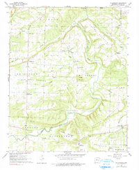
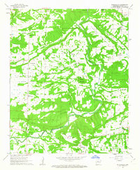
1962 Map of Solgohachia
USGS Topo · Published 1990About this map
Saint Vincent and Solgohachia anchor this 1962 landscape in Conway County, where the terrain is defined by a series of prominent ridges including Nichols Mountain, Bull Mountain, and Pigeon Roost Mountain. The settlement pattern follows the drainage of East Fork Point Remove Creek and its tributaries like Tenny Creek and Prairie Creek. The map provides significant genealogical value through its density of family-named landmarks and rural institutions, such as Vinson Chapel and Wesley Chapel.
Find a feature on this map
49 named features on this map. Tap any name to fly to it.
Don’t see what you’re looking for? This feature index may not catch every label — zoom into the map to look around manually.
Map Details
Editions of this 1962 Solgohachia Map
3 editions found
Other maps of this area

1889 · Morrilton No. 3
USGS Topo · 1:62,500

1892 · Morrillton
USGS Topo · 1:125,000

1894 · Morrillton
USGS Topo · 1:125,000

1956 · Russellville
USGS Topo · 1:250,000

1961 · Menifee
USGS Topo · 1:24,000

1961 · Morrilton East
USGS Topo · 1:24,000

1961 · Morrilton West
USGS Topo · 1:24,000
1962 · Jerusalem
USGS Topo · 1:24,000
1962 · Cleveland
USGS Topo · 1:24,000
1962 · Solgohachia
USGS Topo · 1:24,000