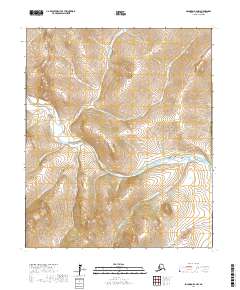
2017 Map of Solomon D-4 NW
USGS Topo · Published 2017About this map
The Niukluk River serves as the central drainage for this section of the Seward Peninsula, winding through a landscape defined by its numerous gold-rush era creek names. This 2017 survey by the U.S. Geological Survey illustrates the remote hydrologic network within the Nome Census Area, where drainage patterns often hint at the region's prospecting history. Prominent tributaries such as Goldbottom Cr, Sweetcake Cr, and Sunnyside Cr feed into the primary river system, reflecting the optimism of miners who once explored these remote valleys. The map clearly delineates the township and range lines, including t6s r26w and t7s r25w, providing essential geographic context for land claims and historical research in this wilderness. Other notable watercourses like Bennett Cr and Richter Cr further define the intricate topography of the Solomon D-4 NW quadrangle.
Find a feature on this map
20 named features on this map. Tap any name to fly to it.
Don’t see what you’re looking for? This feature index may not catch every label — zoom into the map to look around manually.
Map Details
Editions of this 2017 Solomon D-4 NW Map
This is the sole edition of this map. No revisions or reprints were ever made.
Other maps of this area

1907 · Casadepaga
USGS Topo · 1:62,500

1950 · Bendeleben A-4
USGS Topo · 1:63,360

1950 · Bendeleben A-5
USGS Topo · 1:63,360

1950 · Bendeleben
USGS Topo · 1:250,000

1950 · Solomon
USGS Topo · 1:250,000

1950 · Solomon D-4
USGS Topo · 1:63,360

1950 · Solomon D-5
USGS Topo · 1:63,360

1951 · Bendeleben
USGS Topo · 1:250,000

1951 · Solomon
USGS Topo · 1:250,000

1964 · Bendeleben
USGS Topo · 1:250,000