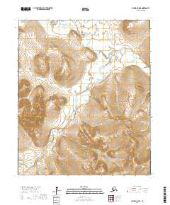
2017 Map of Solomon D-5 NE
USGS Topo · Published 2017About this map
The Seward Peninsula landscape is defined by the winding paths of the Niukluk River and the Casadepaga River, which carve through the interior of this remote region. In this 2017 USGS survey, the intricate network of alpine drainage is evident through numerous named waterways such as American Creek, Bonanza Creek, and Big Four Creek. These names often recall the region's historical associations with prospecting and exploration, particularly in canyons like Ben Gulch and Empire Gulch. The topography rises toward prominent features like Bermudez Bluff and is punctuated by remote tributaries including Puckmummie Creek and Little Dixie Creek. The map provides a precise record of the hydrology and elevation within Townships 6 and 7 South, illustrating the complex drainage patterns of northwestern Alaska.
Find a feature on this map
32 named features on this map. Tap any name to fly to it.
Don’t see what you’re looking for? This feature index may not catch every label — zoom into the map to look around manually.
Map Details
Editions of this 2017 Solomon D-5 NE Map
This is the sole edition of this map. No revisions or reprints were ever made.
Other maps of this area

1907 · Casadepaga
USGS Topo · 1:62,500

1950 · Bendeleben A-4
USGS Topo · 1:63,360

1950 · Bendeleben A-5
USGS Topo · 1:63,360

1950 · Bendeleben
USGS Topo · 1:250,000

1950 · Solomon
USGS Topo · 1:250,000

1950 · Solomon D-4
USGS Topo · 1:63,360

1950 · Solomon D-5
USGS Topo · 1:63,360

1951 · Bendeleben
USGS Topo · 1:250,000

1951 · Solomon
USGS Topo · 1:250,000

1964 · Bendeleben
USGS Topo · 1:250,000