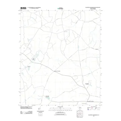
2011 Map of Solomons Crossroads
USGS Topo · Published 2011About this map
Lawtonville Cemetery and the nearby Lawtonville Crossroads anchor the southern reach of this Lowcountry landscape, reflecting the established rural settlement patterns of Hampton County. The topography is defined by slow-moving water systems and drainage basins, including Beech Branch, Blood Hill Creek, and Black Creek, which weave through the agricultural and timbered tracts. Evidence of land management is visible in the numerous small dams and named impoundments like Harpers Pond and Haskel Pond Dam.
Find a feature on this map
39 named features on this map. Tap any name to fly to it.
Don’t see what you’re looking for? This feature index may not catch every label — zoom into the map to look around manually.
Map Details
Editions of this 2011 Solomons Crossroads Map
This is the sole edition of this map. No revisions or reprints were ever made.
Other maps of this area

1918 · Varnville
USGS Topo · 1:62,500

1919 · Pineland
USGS Topo · 1:62,500

1919 · Shirley
USGS Topo · 1:62,500

1920 · Peeples
USGS Topo · 1:62,500

1943 · Pineland
USGS Topo · 1:62,500

1943 · Peeples
USGS Topo · 1:62,500

1943 · Shirley
USGS Topo · 1:62,500

1944 · Varnville
USGS Topo · 1:62,500

1947 · Savannah
USGS Topo · 1:250,000

1948 · Savannah
USGS Topo · 1:250,000