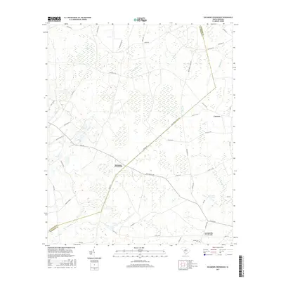
2017 Map of Solomons Crossroads
USGS Topo · Published 2017About this map
Solomons Crossroads sits at the heart of this Lowcountry landscape along the border of Allendale and Hampton Counties. The area is defined by its complex hydrography, where the wetlands of Hog Pen Bay and Levy Bay give way to the winding courses of Beech Branch and Blood Hill Cr. Local settlement patterns follow the high ground, with historically significant sites like the Lawtonville Cem near Lawtonville Crossroads serving as anchor points for family researchers. Notable landmarks like Matthew's Bluff rise above the drainage systems, while water features such as Harpers Pond and Arnes Pond indicate the local management of the region's abundant surface water. The road network, including the diagonal path of Beech Branch Church Rd, connects these rural outposts and family lands in a pattern that has persisted through generations of South Carolina history.
Find a feature on this map
51 named features on this map. Tap any name to fly to it.
Don’t see what you’re looking for? This feature index may not catch every label — zoom into the map to look around manually.
Map Details
Editions of this 2017 Solomons Crossroads Map
This is the sole edition of this map. No revisions or reprints were ever made.
Other maps of this area

1918 · Varnville
USGS Topo · 1:62,500

1919 · Pineland
USGS Topo · 1:62,500

1919 · Shirley
USGS Topo · 1:62,500

1920 · Peeples
USGS Topo · 1:62,500

1943 · Pineland
USGS Topo · 1:62,500

1943 · Peeples
USGS Topo · 1:62,500

1943 · Shirley
USGS Topo · 1:62,500

1944 · Varnville
USGS Topo · 1:62,500

1947 · Savannah
USGS Topo · 1:250,000

1948 · Savannah
USGS Topo · 1:250,000