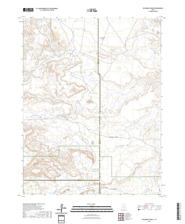
2023 Map of Solomons Temple
USGS Topo · Published 2023About this map
Capitol Reef National Park marks the southern reach of this landscape, where the high desert terrain of Sevier and Emery counties meet. The map is defined by a network of seasonal drainages, most notably Solomon Creek and Temple Wash, which carve through the arid plateaus. Central to the area is the prominent landmark of Solomons Temple, rising above the surrounding Rock Springs Bench. The northern portion of the quadrangle transitions into the Last Chance Desert, a vast expanse segmented by Last Chance Wash. Scattered water sources such as Jeffery Reservoir, Rock Springs, and Birch Spring suggest the critical importance of water management in this high-altitude desert environment. This survey captures the complex intersection of county boundaries and federal park lands in a region primarily shaped by geological erosion and intermittent water flow.
Find a feature on this map
16 named features on this map. Tap any name to fly to it.
Don’t see what you’re looking for? This feature index may not catch every label — zoom into the map to look around manually.
Map Details
Editions of this 2023 Solomons Temple Map
This is the sole edition of this map. No revisions or reprints were ever made.
Other maps of this area

1885 · Fish Lake
USGS Topo · 1:250,000

1896 · Fish Lake
USGS Topo · 1:250,000

1922 · Emery No.3
USGS Topo · 1:31,680

1952 · Notom 2 NW
USGS Topo · 1:24,000

1952 · Notom 2 NE
USGS Topo · 1:24,000

1952 · Torrey
USGS Topo · 1:62,500

1954 · Fruita
USGS Topo · 1:62,500
1954 · Notom 1 NW
USGS Topo · 1:24,000

1956 · Salina
USGS Topo · 1:250,000

1960 · Salina
USGS Topo · 1:250,000