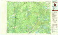
1980 Map of Solon Springs
USGS Topo · Published 1980About this map
Brule River State Forest and the Chequamegon National Forest dominate this 1980 survey of northern Wisconsin, illustrating a landscape defined by glacial lakes and timber management. The area is anchored by settlements such as Solon Springs and Hayward, connected by the route of the Chicago and North Western railroad. The map highlights the extensive hydrological network of the region, from the headwaters of the St Croix Flowage to the winding paths of the Totagatic River and Namekagon River.
Find a feature on this map
101 named features on this map. Tap any name to fly to it.
Don’t see what you’re looking for? This feature index may not catch every label — zoom into the map to look around manually.
Map Details
Editions of this 1980 Solon Springs Map
This is the sole edition of this map. No revisions or reprints were ever made.
Other maps of this area

1915 · Superior
USGS Topo · 1:48,000

1917 · Superior
USGS Topo · 1:62,500

1942 · Ashland
USGS Topo · 1:48,000

1942 · Clam Lake
USGS Topo · 1:48,000

1942 · Marengo
USGS Topo · 1:48,000

1943 · Iron Lake
USGS Topo · 1:48,000

1943 · Namekagon Lake
USGS Topo · 1:48,000

1944 · Moquah
USGS Topo · 1:48,000

1944 · Draper
USGS Topo · 1:48,000

1944 · Couderay
USGS Topo · 1:48,000