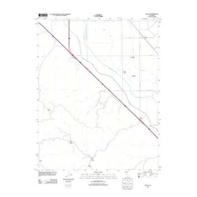
2012 Map of Solyo
USGS Topo · Published 2012About this map
Governor Edmund G Brown California Aqueduct and the Delta-Mendota Canal dominate the landscape in this portion of San Joaquin County, illustrating the massive scale of California's mid-century water infrastructure. The small settlement of Solyo sits in the northeast corner near the Hetch Hetchy Aqueduct, serving as a transition point between the valley floor's industrial waterways and the rising elevations of the Diablo Range. The terrain transitions from flat agricultural lands to the complex topography of the southwest, marked by Chicken Flat and Mount Oso. Numerous drainage features like Hospital Cr, Ingram Cr, and Arkansas Cr flow from the canyons toward the valley, though many are channeled beneath the modern aqueducts. Researchers will find a mix of rural road networks, such as Spencer Rd and Gaffery Rd, alongside specialized irrigation features like Lateral Four North.
Find a feature on this map
33 named features on this map. Tap any name to fly to it.
Don’t see what you’re looking for? This feature index may not catch every label — zoom into the map to look around manually.
Map Details
Editions of this 2012 Solyo Map
This is the sole edition of this map. No revisions or reprints were ever made.
Other maps of this area

1913 · Romain
USGS Topo · 1:31,680

1915 · Vernalis
USGS Topo · 1:31,680

1915 · Ripon
USGS Topo · 1:31,680

1915 · Westley
USGS Topo · 1:31,680

1916 · Patterson
USGS Topo · 1:31,680

1916 · Tracy
USGS Topo · 1:31,680

1916 · Romain
USGS Topo · 1:31,680

1919 · Orestimba
USGS Topo · 1:62,500

1922 · Carbona
USGS Topo · 1:62,500

1938 · Mt. Boardman
USGS Topo · 1:62,500