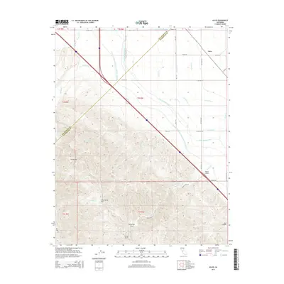
2015 Map of Solyo
USGS Topo · Published 2015About this map
The California Central Valley and the foothills of the Diablo Range meet in this 2015 study, defined by the massive infrastructure required to move water through the arid landscape. Three major arteries—the Hetch Hetchy Aqueduct, the Delta-Mendota Canal, and the Governor Edmund G Brown California Aqueduct—cut through the terrain, illustrating the modern engineering that sustains the region's agriculture. The eastern half of the map is dominated by the geometric layout of irrigation laterals, including Lateral Six N and Hi Line Lateral, which serve the flatlands near the settlement of Solyo.
Find a feature on this map
40 named features on this map. Tap any name to fly to it.
Don’t see what you’re looking for? This feature index may not catch every label — zoom into the map to look around manually.
Map Details
Editions of this 2015 Solyo Map
This is the sole edition of this map. No revisions or reprints were ever made.
Other maps of this area

1913 · Romain
USGS Topo · 1:31,680

1915 · Vernalis
USGS Topo · 1:31,680

1915 · Ripon
USGS Topo · 1:31,680

1915 · Westley
USGS Topo · 1:31,680

1916 · Patterson
USGS Topo · 1:31,680

1916 · Tracy
USGS Topo · 1:31,680

1916 · Romain
USGS Topo · 1:31,680

1919 · Orestimba
USGS Topo · 1:62,500

1922 · Carbona
USGS Topo · 1:62,500

1938 · Mt. Boardman
USGS Topo · 1:62,500