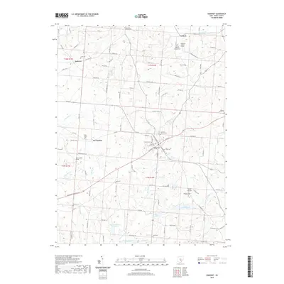
2019 Map of Somerset
USGS Topo · Published 2019About this map
Somerset serves as the central hub for this Perry County landscape, where the terrain is marked by numerous historic burial grounds and water control structures. The religious heritage of the area is particularly evident in the presence of the New Saint Josephs Priory Cem and Old Saint Josephs Priory Cem located near Lake Saint Joseph. These sites, along with others like the Hopewell Methodist Episcopal Cem, provide significant touchpoints for genealogical research in the region.
Find a feature on this map
110 named features on this map. Tap any name to fly to it.
Don’t see what you’re looking for? This feature index may not catch every label — zoom into the map to look around manually.
Map Details
Editions of this 2019 Somerset Map
This is the sole edition of this map. No revisions or reprints were ever made.
Other maps of this area

1907 · Logan
USGS Topo · 1:62,500

1909 · Thornville
USGS Topo · 1:62,500

1909 · Logan
USGS Topo · 1:62,500

1910 · Zanesville
USGS Topo · 1:62,500

1911 · New Lexington
USGS Topo · 1:62,500

1947 · Columbus
USGS Topo · 1:250,000

1961 · Columbus
USGS Topo · 1:250,000

1961 · Rushville
USGS Topo · 1:24,000
1961 · Thornville
USGS Topo · 1:24,000

1961 · New Lexington
USGS Topo · 1:24,000