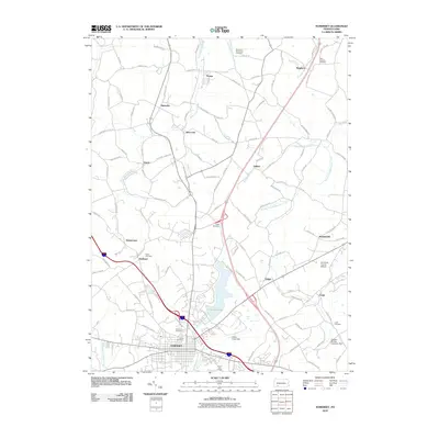
2010 Map of Somerset
USGS Topo · Published 2010About this map
Somerset anchors this portion of the Laurel Highlands, positioned at a vital junction of local and regional transit. By the early 21st century, the landscape reveals a complex network of small settlements and mining-related infrastructure, such as the Oneida Mining Company Dam and the Coxes Creek Dam. The presence of several family and community burial grounds, including Saint Josephs Cemetery and the Husband Cemetery, provides a wealth of information for genealogists tracking lineages in the Somerset area. To the north and east, the map traces the drainages of Quernahoning Creek and Wells Creek, which define the undulating terrain surrounding villages like Acosta, Quecreek, and Listie. The substantial basin of Lake Somerset serves as a prominent landmark just north of the borough, reflecting the region's managed water resources and recreational spaces.
Find a feature on this map
111 named features on this map. Tap any name to fly to it.
Don’t see what you’re looking for? This feature index may not catch every label — zoom into the map to look around manually.
Map Details
Editions of this 2010 Somerset Map
This is the sole edition of this map. No revisions or reprints were ever made.
Other maps of this area

1913 · Somerset
USGS Topo · 1:62,500

1914 · Windber
USGS Topo · 1:62,500

1915 · Somerset
USGS Topo · 1:62,500

1916 · Windber
USGS Topo · 1:62,500

1921 · Meyersdale
USGS Topo · 1:62,500

1923 · Berlin
USGS Topo · 1:48,000

1929 · Berlin
USGS Topo · 1:62,500

1939 · Meyersdale
USGS Topo · 1:62,500

1944 · Somerset
USGS Topo · 1:62,500

1944 · Windber
USGS Topo · 1:62,500
Featured Places
- Somerset, PA
- Jenner Township, PA
- Somerset Township, PA
- Geiger, Somerset Township
- Ralphton, Quemahoning Township