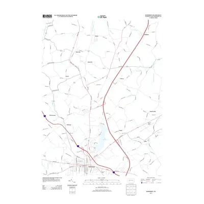
2013 Map of Somerset
USGS Topo · Published 2013About this map
Somerset serves as the focal point of this Pennsylvania landscape, where the town’s grid meets a network of outlying hamlets and industrial sites. The topography is defined by significant water bodies and drainage systems, most notably Lake Somerset and the winding course of Quemahoning Cr to the north. Smaller settlements like Quecreek, Sipesville, and Acosta are interspersed among a dense web of local roads, reflecting the region's long-standing connection to local mining and agriculture. Transportation infrastructure is prominent, featuring the Somerset County Airport and major corridors such as US-219. The map details a transition from the dense residential blocks of the county seat to more distributed rural clusters like Listie and Ralphton, providing a clear look at the residential and logistical layout of the county in the early 21st century.
Find a feature on this map
151 named features on this map. Tap any name to fly to it.
Don’t see what you’re looking for? This feature index may not catch every label — zoom into the map to look around manually.
Map Details
Editions of this 2013 Somerset Map
This is the sole edition of this map. No revisions or reprints were ever made.
Other maps of this area

1913 · Somerset
USGS Topo · 1:62,500

1914 · Windber
USGS Topo · 1:62,500

1915 · Somerset
USGS Topo · 1:62,500

1916 · Windber
USGS Topo · 1:62,500

1921 · Meyersdale
USGS Topo · 1:62,500

1923 · Berlin
USGS Topo · 1:48,000

1929 · Berlin
USGS Topo · 1:62,500

1939 · Meyersdale
USGS Topo · 1:62,500

1944 · Somerset
USGS Topo · 1:62,500

1944 · Windber
USGS Topo · 1:62,500
Featured Places
- Somerset, PA
- Jenner Township, PA
- Somerset Township, PA
- Geiger, Somerset Township
- Ralphton, Quemahoning Township