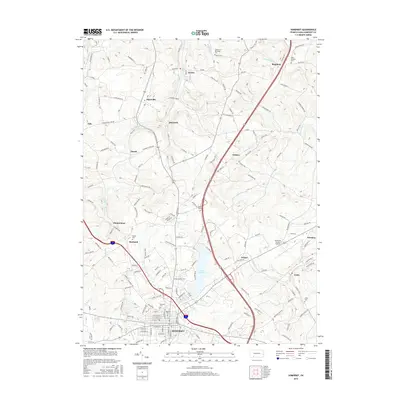
2016 Map of Somerset
USGS Topo · Published 2016About this map
Somerset serves as the focal point of this southwestern Pennsylvania landscape, which is characterized by a dense network of small settlements and family-named roads. The map reveals a cluster of outlying communities including Acosta, Sipesville, and Quecreek, connected by a complex system of local thoroughfares such as Twin Hills Rd and Ralphton Rd. Several historic burying grounds are documented across the terrain, notably Husband Cem, Union Cem, and Saint Josephs Cem, providing valuable data points for genealogical research in Somerset County.
Find a feature on this map
157 named features on this map. Tap any name to fly to it.
Don’t see what you’re looking for? This feature index may not catch every label — zoom into the map to look around manually.
Map Details
Editions of this 2016 Somerset Map
This is the sole edition of this map. No revisions or reprints were ever made.
Other maps of this area

1913 · Somerset
USGS Topo · 1:62,500

1914 · Windber
USGS Topo · 1:62,500

1915 · Somerset
USGS Topo · 1:62,500

1916 · Windber
USGS Topo · 1:62,500

1921 · Meyersdale
USGS Topo · 1:62,500

1923 · Berlin
USGS Topo · 1:48,000

1929 · Berlin
USGS Topo · 1:62,500

1939 · Meyersdale
USGS Topo · 1:62,500

1944 · Somerset
USGS Topo · 1:62,500

1944 · Windber
USGS Topo · 1:62,500
Featured Places
- Somerset, PA
- Jenner Township, PA
- Somerset Township, PA
- Geiger, Somerset Township
- Ralphton, Quemahoning Township