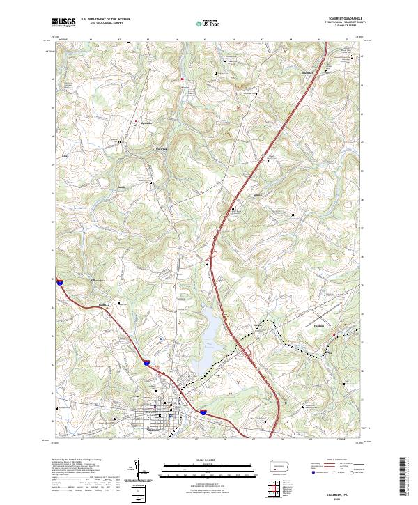
2023 Map of Somerset
USGS Topo · Published 2023About this map
Lake Somerset sits at the center of this Pennsylvania landscape, surrounded by a dense network of early settlements and family burial grounds that reflect the long history of Somerset. The town serves as a regional anchor, with the Courthouse and Ankeny Square Burial Ground marking its civic and historic heart. Radiating outward from the county seat, the terrain is defined by the winding paths of Quemahoning Creek and Beaverdam Creek, which carved the valleys where communities like Sipesville, Acosta, and Friedens established themselves.
Find a feature on this map
195 named features on this map. Tap any name to fly to it.
Don’t see what you’re looking for? This feature index may not catch every label — zoom into the map to look around manually.
Map Details
Editions of this 2023 Somerset Map
This is the sole edition of this map. No revisions or reprints were ever made.
Other maps of this area

1913 · Somerset
USGS Topo · 1:62,500

1914 · Windber
USGS Topo · 1:62,500

1915 · Somerset
USGS Topo · 1:62,500

1916 · Windber
USGS Topo · 1:62,500

1921 · Meyersdale
USGS Topo · 1:62,500

1923 · Berlin
USGS Topo · 1:48,000

1929 · Berlin
USGS Topo · 1:62,500

1939 · Meyersdale
USGS Topo · 1:62,500

1944 · Somerset
USGS Topo · 1:62,500

1944 · Windber
USGS Topo · 1:62,500