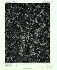
1977 Map of Somerset
USGS Topo · Published 1979About this map
Somerset anchors the southern portion of this orthophotoquad, showing the dense residential and commercial expansion of the borough in the late 1970s. The landscape is defined by the heavy infrastructure of the era, most notably the junction of 70 76 and Highway 219. These major transportation arteries cut through a patchwork of contoured farmland and woodlots, illustrating the shift toward modern regional connectivity. To the north, smaller clusters like Sipe Sville and Geiger maintain their rural character amidst the surrounding agricultural fields. This 1977 aerial perspective, produced in cooperation with the Soil Conservation Service, provides a clear view of land use patterns and field terracing typical of this part of Pennsylvania before further suburban development altered the outskirts of the county seat.
Find a feature on this map
7 named features on this map. Tap any name to fly to it.
Don’t see what you’re looking for? This feature index may not catch every label — zoom into the map to look around manually.
Map Details
Editions of this 1977 Somerset Map
This is the sole edition of this map. No revisions or reprints were ever made.
Other maps of this area

1913 · Somerset
USGS Topo · 1:62,500

1914 · Windber
USGS Topo · 1:62,500

1915 · Somerset
USGS Topo · 1:62,500

1916 · Windber
USGS Topo · 1:62,500

1921 · Meyersdale
USGS Topo · 1:62,500

1923 · Berlin
USGS Topo · 1:48,000

1929 · Berlin
USGS Topo · 1:62,500

1939 · Meyersdale
USGS Topo · 1:62,500

1944 · Somerset
USGS Topo · 1:62,500

1944 · Windber
USGS Topo · 1:62,500
Featured Places
- Somerset, PA
- Quemahoning Township, PA
- Jenner Township, PA
- Somerset Township, PA
- Ralphton, Quemahoning Township