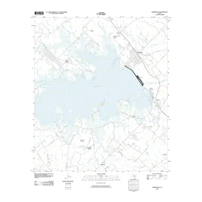
2010 Map of Somerville
USGS Topo · Published 2010About this map
Somerville stands as a primary focal point at the northeastern edge of the massive Somerville Lake impoundment. This reservoir, held by the significant Somerville Dam, dominates the local geography and creates a complex shoreline that surrounds numerous physical landmarks. To the east of the water, Green Mountain rises near a large Quarry, while to the south, Shepherd Mountain and Johnsons Mountain overlook the Johnsons Mountain Lake and its associated dam. The distribution of cemeteries across the landscape, including the Mexican Cemetery Association Cemetery, Schoppe Cemetery, and Williams Cemetery, provides valuable markers for genealogical research in this part of Burleson County.
Find a feature on this map
74 named features on this map. Tap any name to fly to it.
Don’t see what you’re looking for? This feature index may not catch every label — zoom into the map to look around manually.
Map Details
Editions of this 2010 Somerville Map
This is the sole edition of this map. No revisions or reprints were ever made.
Other maps of this area

1914 · Gay Hill
USGS Topo · 1:62,500

1930 · Brenham
USGS Topo · 1:62,500

1954 · Austin
USGS Topo · 1:250,000

1956 · Brenham
USGS Topo · 1:62,500

1956 · Somerville
USGS Topo · 1:62,500

1958 · Carmine
USGS Topo · 1:24,000

1958 · Burton
USGS Topo · 1:24,000

1959 · Flag Pond
USGS Topo · 1:24,000

1959 · Gay Hill
USGS Topo · 1:24,000

1959 · Somerville
USGS Topo · 1:24,000