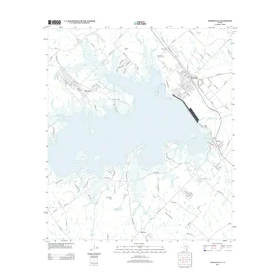
2013 Map of Somerville
USGS Topo · Published 2013About this map
Somerville stands as a rail-focused hub in the early 21st century, dominated by the BNSF Railway corridor that bisects the town. To the west, the massive expanse of Somerville Lake defines the local geography, created by the impoundment of Yegua Cr. The landscape is a mix of sprawling water and low-lying hills, including Shepherd Mtn and the Apache Hls. Small, scattered communities like Rehburg and the riverside settlement of Big Creek are documented, alongside several local burial sites including Schoppe Cem, Oak Lawn Cem, and the Mexican Cem Association Cem. The Presence of a Quarry near Green Mtn indicates ongoing industrial activity, while numerous creeks such as Wolf Cr and Thompson Cr feed into the primary reservoir system.
Find a feature on this map
139 named features on this map. Tap any name to fly to it.
Don’t see what you’re looking for? This feature index may not catch every label — zoom into the map to look around manually.
Map Details
Editions of this 2013 Somerville Map
This is the sole edition of this map. No revisions or reprints were ever made.
Other maps of this area

1914 · Gay Hill
USGS Topo · 1:62,500

1930 · Brenham
USGS Topo · 1:62,500

1954 · Austin
USGS Topo · 1:250,000

1956 · Brenham
USGS Topo · 1:62,500

1956 · Somerville
USGS Topo · 1:62,500

1958 · Carmine
USGS Topo · 1:24,000

1958 · Burton
USGS Topo · 1:24,000

1959 · Flag Pond
USGS Topo · 1:24,000

1959 · Gay Hill
USGS Topo · 1:24,000

1959 · Somerville
USGS Topo · 1:24,000