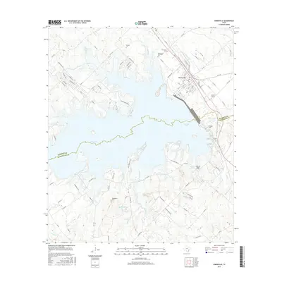
2016 Map of Somerville
USGS Topo · Published 2016About this map
Somerville Lake dominates the central landscape of this 2016 survey, where the waters of Yegua Creek are impounded along the Burleson and Washington county line. The city of Somerville serves as the primary hub, its street grid oriented toward the active BNSF Railway corridor. This rail-dependent layout is contrasted by the burgeoning recreational developments and residential loops like Lakeview Loop and Oak Ridge that line the lake's northern fingers. Genealogists will find several burial sites preserved across the terrain, including Schoppe Cem, Oak Lawn Cem, and the uniquely named Graveyard Crossing Cem. Beyond the water's edge, the topography rises toward Shepherd Mtn and Green Mtn, while small private airfields like the Lucky Star Ranch Airport and numerous named creeks such as Sweet Water Cr and Old Rocky Cr define the rural stretches between settlements.
Find a feature on this map
110 named features on this map. Tap any name to fly to it.
Don’t see what you’re looking for? This feature index may not catch every label — zoom into the map to look around manually.
Map Details
Editions of this 2016 Somerville Map
This is the sole edition of this map. No revisions or reprints were ever made.
Other maps of this area

1914 · Gay Hill
USGS Topo · 1:62,500

1930 · Brenham
USGS Topo · 1:62,500

1954 · Austin
USGS Topo · 1:250,000

1956 · Brenham
USGS Topo · 1:62,500

1956 · Somerville
USGS Topo · 1:62,500

1958 · Carmine
USGS Topo · 1:24,000

1958 · Burton
USGS Topo · 1:24,000

1959 · Flag Pond
USGS Topo · 1:24,000

1959 · Gay Hill
USGS Topo · 1:24,000

1959 · Somerville
USGS Topo · 1:24,000