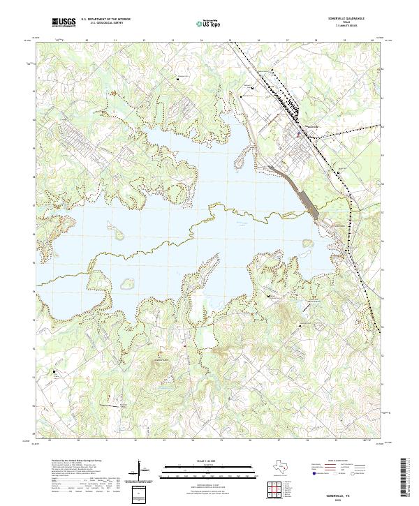
2022 Map of Somerville
USGS Topo · Published 2022About this map
Somerville stands as the primary hub in this corner of the Post Oak Savannah, situated near the north shore of the expansive Somerville Lake. The map details a landscape where water and topography dictate the layout of rural life, from the lowlands of Yegua Creek to the modest elevations of Green Mtn and Shepherd Mtn. For genealogists, the map is particularly dense with small family and community burial grounds, including the Mexican Cem, Schoppe Cem, and Flat Prairie Cem, which reflect the area's diverse settlement history. Transportation and recreation are central themes, evidenced by the clustered residential streets of Somerville and the seasonal access points around Welch Park and Birch Creek. To the south, Robbins Lake and Johnsons Mountain Lake further define the local hydrology, while the presence of the Lucky Star Ranch Airport adds a modern aviation element to this traditionally agricultural and leisure-focused Texas landscape.
Find a feature on this map
133 named features on this map. Tap any name to fly to it.
Don’t see what you’re looking for? This feature index may not catch every label — zoom into the map to look around manually.
Map Details
Editions of this 2022 Somerville Map
This is the sole edition of this map. No revisions or reprints were ever made.
Other maps of this area

1914 · Gay Hill
USGS Topo · 1:62,500

1930 · Brenham
USGS Topo · 1:62,500

1954 · Austin
USGS Topo · 1:250,000

1956 · Brenham
USGS Topo · 1:62,500

1956 · Somerville
USGS Topo · 1:62,500

1958 · Carmine
USGS Topo · 1:24,000

1958 · Burton
USGS Topo · 1:24,000

1959 · Flag Pond
USGS Topo · 1:24,000

1959 · Gay Hill
USGS Topo · 1:24,000

1959 · Somerville
USGS Topo · 1:24,000