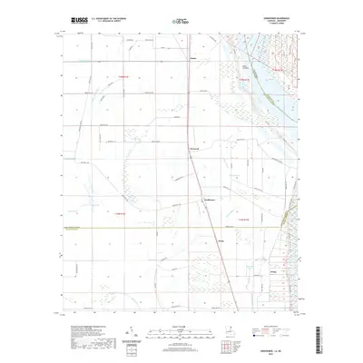
2020 Map of Sondheimer
USGS Topo · Published 2020About this map
The Mississippi River forms the eastern boundary of this Delta landscape, where the fertile alluvial plain is defined by a dense network of bayous and drainage ditches. Small settlements such as Alsatia, Sondheimer, and Enoka are positioned along the primary north-south transit corridor, surrounded by agricultural fields divided into the Public Land Survey System’s township and range grid. The presence of Salem Crevasse near the river levee speaks to the region's history of flooding and the power of the river's course. Local hydrology is complex, with Little Tensas Bayou, Wildcat Bayou, and Talla Bena Bayou meandering through the flat terrain. For genealogists and local historians, the map's detailed labeling of parish roads, including Parish Rd 1106 and Parish Rd 1122, provides a clear view of the rural infrastructure connecting the community's farms and residences.
Find a feature on this map
66 named features on this map. Tap any name to fly to it.
Don’t see what you’re looking for? This feature index may not catch every label — zoom into the map to look around manually.
Map Details
Editions of this 2020 Sondheimer Map
This is the sole edition of this map. No revisions or reprints were ever made.
Other maps of this area

1909 · Millikens Bend
USGS Topo · 1:24,000

1909 · Tallulah
USGS Topo · 1:24,000

1935 · Waverly
USGS Topo · 1:62,500

1939 · Talla Bena
USGS Topo · 1:62,500

1939 · Alsatia
USGS Topo · 1:62,500

1955 · Jackson
USGS Topo · 1:250,000

1959 · Mitchiner
USGS Topo · 1:62,500

1961 · Jackson
USGS Topo · 1:250,000

1961 · Waverly
USGS Topo · 1:62,500

1962 · Jackson
USGS Topo · 1:250,000