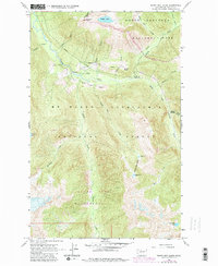
1963 Map of Sonny Boy Lakes
USGS Topo · Published 1982About this map
Hidden Lake Lookout stands atop the Hidden Lake Peaks, overlooking a landscape defined by the convergence of the North Fork and South Fork Cascade River. This high-elevation terrain is shared by the North Cascades National Park and the Mount Baker Snoqualmie National Forest, with the southern reaches protected by the Glacier Peak Wilderness.
Find a feature on this map
33 named features on this map. Tap any name to fly to it.
Don’t see what you’re looking for? This feature index may not catch every label — zoom into the map to look around manually.
Map Details
Editions of this 1963 Sonny Boy Lakes Map
3 editions found
Other maps of this area

1899 · Glacier Peak
USGS Topo · 1:125,000

1901 · Glacier Peak
USGS Topo · 1:125,000

1953 · Marblemount
USGS Topo · 1:62,500

1955 · Concrete
USGS Topo · 1:250,000

1958 · Concrete
USGS Topo · 1:250,000

1962 · Concrete
USGS Topo · 1:250,000

1963 · Sonny Boy Lakes
USGS Topo · 1:24,000

1963 · Eldorado Peak
USGS Topo · 1:24,000
1963 · Forbidden Peak
USGS Topo · 1:24,000
1963 · Downey Mtn
USGS Topo · 1:24,000