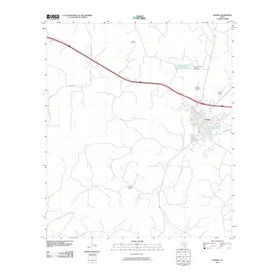
2010 Map of Sonora
USGS Topo · Published 2010About this map
The town of Sonora serves as the focal point of this West Texas landscape, where the confluence of modern infrastructure and arid terrain is clearly visible. The area is defined by the ephemeral Dry Devils River and its associated flood control structures, including the Soil Conservation Service Site 8 Reservoir and its companion Soil Conservation Service Site 8 Dam. These water management features are critical to a region carved by seasonal drainages like Lowrey Draw and Shurley Draw. To the north, the industrial footprint of the Meckel Gas Field and the Meridan Oil Gasplant Rd highlights the local energy economy. Transportation routes such as the Old Ft Mckavett Rd and the proximity of the Sonora Municipal Airport underscore the town's role as a regional hub for Sutton County during this period in the early 21st century.
Find a feature on this map
19 named features on this map. Tap any name to fly to it.
Don’t see what you’re looking for? This feature index may not catch every label — zoom into the map to look around manually.
Map Details
Editions of this 2010 Sonora Map
This is the sole edition of this map. No revisions or reprints were ever made.
Other maps of this area

1954 · Sonora
USGS Topo · 1:250,000

1958 · Sonora
USGS Topo · 1:250,000

1964 · Sonora
USGS Topo · 1:24,000

1964 · Sonora SE
USGS Topo · 1:24,000

1964 · Sonora NE
USGS Topo · 1:24,000

1964 · Sonora NW
USGS Topo · 1:24,000

1967 · Savell Ranch
USGS Topo · 1:24,000

1967 · Dunbar Draw NW
USGS Topo · 1:24,000

1967 · Dunbar Draw NE
USGS Topo · 1:24,000

1967 · Hudspeth Draw
USGS Topo · 1:24,000