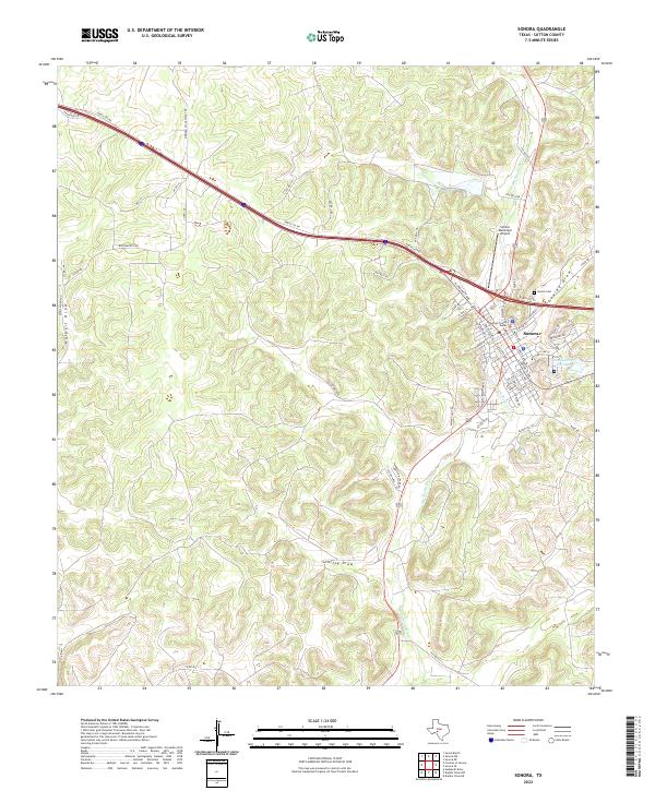
2022 Map of Sonora
USGS Topo · Published 2022About this map
Sonora serves as the focal point of this West Texas landscape, where the town's residential grid meets the rugged catchment of the Dry Devils River. The map highlights a community deeply integrated with its physical geography, as evidenced by the numerous drainage features like Shurley Draw, Halbert Draw, and Lowrey Draw that carve through the limestone terrain. Civic and infrastructure hubs are clearly marked, including the Sutton County Annex, the Sonora Municipal Airport, and the Sonora Cem on the eastern edge of town. A complex network of service and private roads, such as North Svc Rd and Meridian Oil Gasplant Rd, reflects the industrial and ranching activity surrounding the settlement. The inclusion of Site Number Thirteen further suggests a landscape shaped by specialized water management or survey projects common to this arid region.
Find a feature on this map
56 named features on this map. Tap any name to fly to it.
Don’t see what you’re looking for? This feature index may not catch every label — zoom into the map to look around manually.
Map Details
Editions of this 2022 Sonora Map
This is the sole edition of this map. No revisions or reprints were ever made.
Other maps of this area

1954 · Sonora
USGS Topo · 1:250,000

1958 · Sonora
USGS Topo · 1:250,000

1964 · Sonora
USGS Topo · 1:24,000

1964 · Sonora SE
USGS Topo · 1:24,000

1964 · Sonora NE
USGS Topo · 1:24,000

1964 · Sonora NW
USGS Topo · 1:24,000

1967 · Savell Ranch
USGS Topo · 1:24,000

1967 · Dunbar Draw NW
USGS Topo · 1:24,000

1967 · Dunbar Draw NE
USGS Topo · 1:24,000

1967 · Hudspeth Draw
USGS Topo · 1:24,000