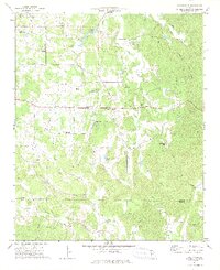
1972 Map of Sonoraville
USGS Topo · Published 1974About this map
The agrarian communities of Gordon and Bartow Counties are defined by a dense network of mountain-fed waterways, including Pine Log Creek and the meandering Salacoa Creek. This early 1970s landscape centers on the historic crossroads of Sonoraville, where local social life converged at the Sonoraville Sch and the Gaines Sch. The map reveals a deeply rooted settlement pattern of small farms and family-named landmarks like Yarbroughs Mill and Mosteller Spring, illustrating the late-century transition from subsistence farming to more modern land use.
Find a feature on this map
44 named features on this map. Tap any name to fly to it.
Don’t see what you’re looking for? This feature index may not catch every label — zoom into the map to look around manually.
Map Details
Editions of this 1972 Sonoraville Map
2 editions found
Other maps of this area

1886 · Dalton
USGS Topo · 1:125,000

1890 · Cartersville
USGS Topo · 1:125,000

1891 · Cartersville
USGS Topo · 1:125,000

1892 · Dalton
USGS Topo · 1:125,000

1896 · Cartersville
USGS Topo · 1:125,000

1897 · Dalton
USGS Topo · 1:125,000

1914 · Talking Rock
USGS Topo · 1:62,500

1916 · Talking Rock
USGS Topo · 1:62,500

1941 · Adairsville
USGS Topo · 1:62,500

1944 · Adairsville
USGS Topo · 1:62,500