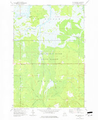
1973 Map of Soo Junction
USGS Topo · Published 1977About this map
Soo Junction sits at a remote rail intersection within the expansive Tahquamenon State Forest of Michigan's Upper Peninsula. This 1973 survey details a landscape defined by its timber and transportation history, where the Soo Line Railroad cuts through the marshy lowlands near the Tahquamenon River and its tributaries like the Sage River. The presence of several Old Railroad Grades and a Private Railroad suggests a legacy of logging operations that once moved through these woods. To the south, McLeods Corner serves as a small highway landmark along Hendricks Quarry Road, while the inclusion of the Winter Trail and Sage Truck Trail underscores the seasonal and industrial nature of navigation in McMillan and Pentland townships. Local landmarks such as a Quarry and a Roadside Park break the dense forest cover near Frenchmans Lake.
Find a feature on this map
19 named features on this map. Tap any name to fly to it.
Don’t see what you’re looking for? This feature index may not catch every label — zoom into the map to look around manually.
Map Details
Editions of this 1973 Soo Junction Map
This is the sole edition of this map. No revisions or reprints were ever made.
Other maps of this area

1931 · Epoufette NW
USGS Topo · 1:31,680

1931 · Gilchrist NE
USGS Topo · 1:31,680

1931 · Gilchrist NW
USGS Topo · 1:31,680

1951 · Big Beaver Creek
USGS Topo · 1:24,000

1951 · Hulbert
USGS Topo · 1:24,000

1951 · Eckerman
USGS Topo · 1:62,500

1954 · Sault Sainte Marie
USGS Topo · 1:250,000

1956 · Sault Sainte Marie
USGS Topo · 1:250,000

1957 · Sault Sainte Marie
USGS Topo · 1:250,000

1958 · Sault Sainte Marie
USGS Topo · 1:250,000