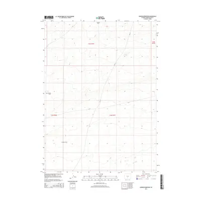
2015 Map of Sooner Reservoir
USGS Topo · Published 2015About this map
Sooner Reservoir sits at the heart of this high-altitude landscape in Sweetwater County, serving as a rare focal point for water management in an arid region defined by seasonal drainage systems. The topography is shaped by the winding courses of Stratton Draw and Battle Spring Draw, which underscore the geographic challenges of the Wyoming high desert. A network of secondary transportation routes, including CR-63 and BLM-3215, traverses the area, reflecting the infrastructure required to manage public and ranch lands during the early 21st century. This map documents the precise township and range boundaries, such as t25n r92w and t24n r92w, which are vital for researchers tracking land use and resource management in this corner of the state.
Find a feature on this map
9 named features on this map. Tap any name to fly to it.
Don’t see what you’re looking for? This feature index may not catch every label — zoom into the map to look around manually.
Map Details
Editions of this 2015 Sooner Reservoir Map
This is the sole edition of this map. No revisions or reprints were ever made.
Other maps of this area

1954 · Rawlins
USGS Topo · 1:250,000

1955 · Casper
USGS Topo · 1:250,000

1958 · Rawlins
USGS Topo · 1:250,000

1958 · Casper
USGS Topo · 1:250,000

1960 · Battle Spring
USGS Topo · 1:24,000

1960 · Hansen Lake NE
USGS Topo · 1:24,000

1960 · Sooner Reservoir
USGS Topo · 1:24,000

1960 · Larsen Knoll
USGS Topo · 1:24,000

1960 · Hansen Lake
USGS Topo · 1:24,000

1960 · Chicken Spring
USGS Topo · 1:24,000